

Lake Whippoorwill Taxing District
Welcome to the Lake Whippoorwill Online Clubhouse — a space for neighbors who care about our lake! Share ideas, ask Orange County EPD questions, and connect with others to plan events and projects that protect and enhance life in and around Lake Whippoorwill. Whether you’re a longtime resident or new to the area, explore the page and discover ways to get involved in keeping our lake clean, healthy, and enjoyable.
-
BioBase Map
Share BioBase Map on Facebook Share BioBase Map on X (formerly Twitter) Share BioBase Map on Linkedin Email BioBase Map link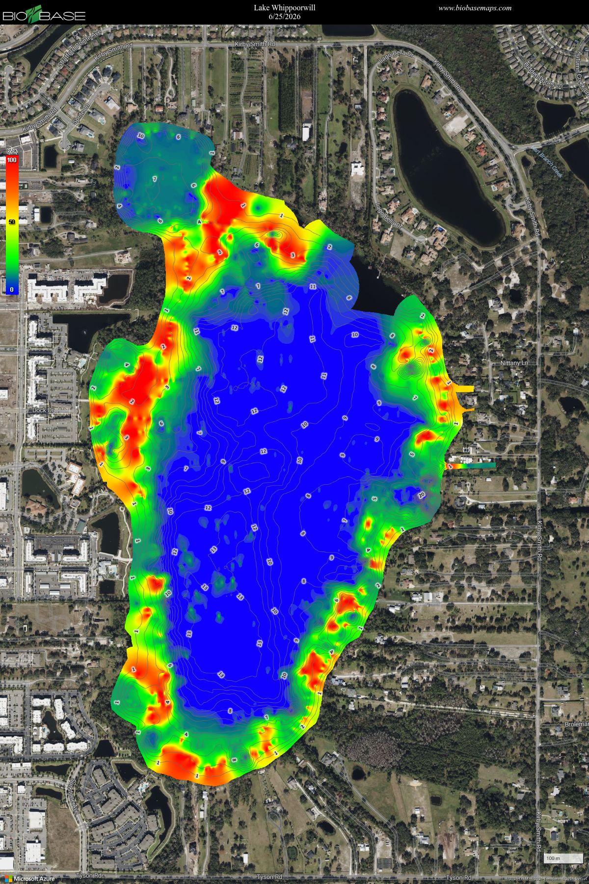
BioBase generates Vegetation Biovolume (BV) heat maps that visualize aquatic plant density and height relative to total water depth. The map below from June 25, 2026 shows the density of aquatic vegetation in Lake Whippoorwill. The red is 100% biovolume vegetation density and blue is 0% biovolume vegetation density.
-
Sign Up for Alerts
Share Sign Up for Alerts on Facebook Share Sign Up for Alerts on X (formerly Twitter) Share Sign Up for Alerts on Linkedin Email Sign Up for Alerts linkSign up for Orange County Alerts
 OCFL Alert is a first-of-its-kind emergency notification and information smartphone app that provides critical information during times of emergency. Life-saving information includes open shelter locations, water and ice distribution centers, evacuation routes, public service announcements and much more. ( Android | Apple)
 OC ALERT is an alert system that allows Orange County Government to contact you via email or cell phone text message during an emergency affecting Orange County. Register free-of-charge for OCAlert.


-

Phone 407-836-1400 Email Lakes@ocfl.net